Core Skills Analysis
History
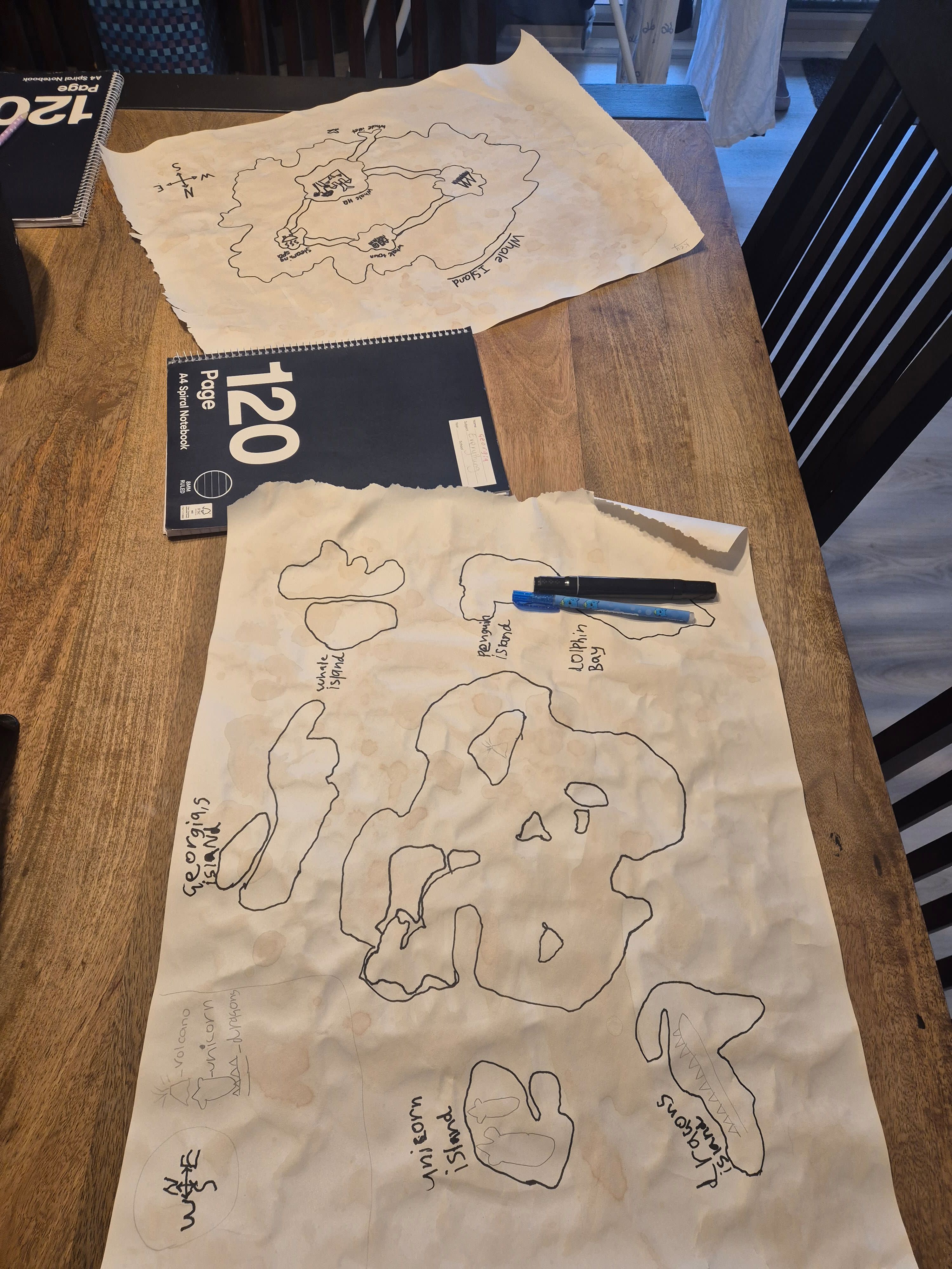
- Georgia practiced map-based historical thinking by creating an invented island region, which shows an understanding that maps can represent places, borders, and settlements.
- By labeling areas like ‘White Island,’ ‘Penguin Island,’ and other named locations, she showed how people or groups give meaning to places through naming, a skill connected to geography and history.
- The compass rose on the page suggests she is learning how map orientation helps readers understand where places are located relative to one another.
- Making a story to go with the map encourages early cause-and-effect thinking about how different places might relate, travel, or develop over time.
Art
- Georgia used line drawing to outline many island shapes, showing control over form, spatial arrangement, and visual planning on a large sheet of paper.
- The repeated outlines and varied island sizes suggest she explored composition and how to fill a page with balanced but distinct shapes.
- The torn-paper edges and visible hand-drawn labels give the project a handmade, creative character that reflects personal style and effort.
- Her choice to add small symbols and simple sketches inside some islands shows beginning illustration skills and attention to visual storytelling.
English
- Georgia demonstrated narrative writing skills by making up a story to match her map, which connects visual details to invented events and characters.
- The labeled islands show purposeful word choice and spelling practice, especially with place names that help readers follow the story world.
- This activity supports descriptive language development because the map invites her to explain where things are and what makes each island different.
- Her work shows early planning for writing, since she likely had to organize ideas before creating the map and story together.
Tips
Tips: To extend this project, invite Georgia to turn her map into a short illustrated storybook, with one page for each island and a sentence or two describing what happens there. She could also create a legend for the map using symbols for mountains, animals, boats, or special landmarks, which would deepen both map reading and storytelling. Another rich extension is to compare her imaginary islands with a real map of islands or archipelagos, helping her notice how land, water, and distance work in real geography. Finally, encourage a simple oral presentation where she ‘guides’ a listener through the islands in order, building speaking confidence and sequencing skills while keeping the activity imaginative and fun.
Book Recommendations
- Treasure Island by Robert Louis Stevenson: A classic adventure story set around islands, maps, and hidden treasure—great for connecting geography and imagination.
- Me on the Map by Joan Sweeney: A kid-friendly introduction to maps, places, and location that helps children understand how maps represent the world.
- There Was an Old Lady Who Swallowed a Fly by Simms Taback: A playful, illustrated story that encourages sequencing, creativity, and observation of visual details.
Try This Next
- Write 3 quiz questions about the map: Which island is largest? Where is the compass rose? Which island name sounds most like a character or place?
- Create a map legend with 4 symbols, then add those symbols to the islands and explain what each one means.
- Draw one new island and write 2–3 sentences describing who lives there and what makes it special.
- Turn the map into a beginning-middle-end story outline with a clear problem and solution.