Core Skills Analysis
Geography and Map Skills
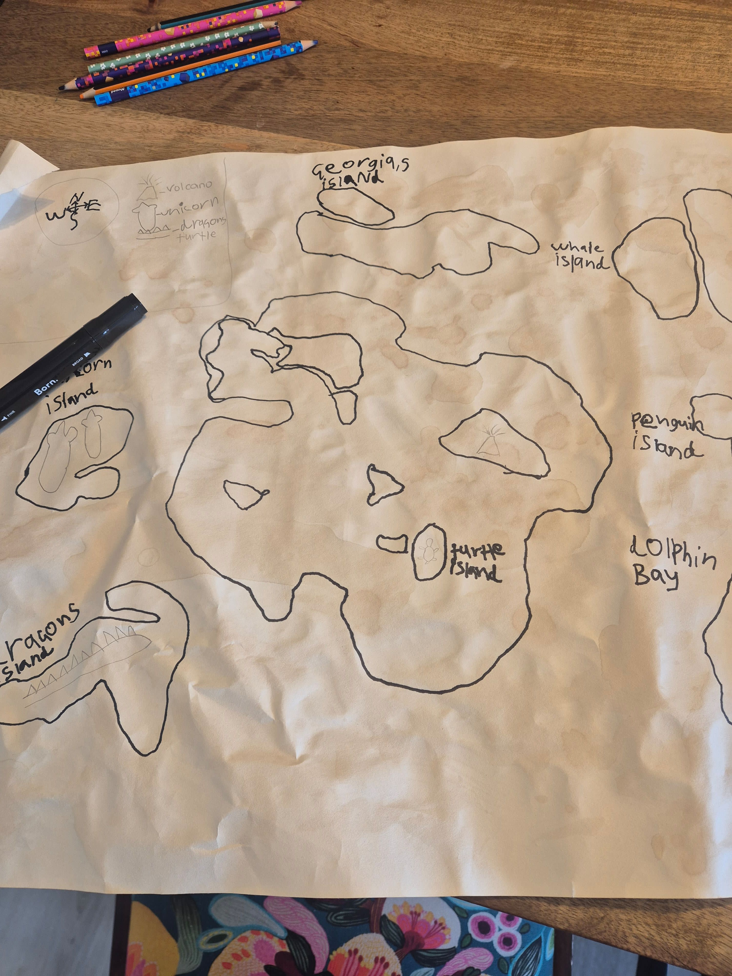
- The learner practiced representing places from a bird’s-eye view by drawing separate landmasses, islands, bays, and surrounding water.
- The map includes a compass rose with north, south, east, and west, showing an emerging understanding of directional language.
- Labels such as “Georgia’s Island,” “Whale Island,” “Turtle Island,” and “Colphin Bay” connect names to specific locations on the map.
- The learner explored geographic features by including islands, a bay, and a volcano in an original map rather than copying a real-world map.
Science and Life Science
- The map identifies animals—including a whale, penguin, turtle, dragons, and a unicorn—as inhabitants or symbols of different places.
- Drawing a volcano creates an opportunity to connect imaginary geography with the real scientific idea that volcanic activity can shape land.
- The variety of animals encourages classification discussions, such as comparing ocean animals, land animals, real animals, and mythical creatures.
- The named islands and bay show an understanding that living things and environments can be connected to particular habitats or regions.
Language Arts
- The learner practiced functional writing by labeling map locations with names such as “Georgia’s Island” and “Colphin Bay.”
- Invented place names and creatures support vocabulary development, imaginative thinking, and world-building.
- The map can serve as a setting for narrative writing because each island, bay, and creature offers a possible story location.
- The handwritten labels show practice with spelling, capitalization, and communicating meaning through concise words and phrases.
Mathematics and Spatial Reasoning
- Creating a large connected map required judging position, distance, size, and relative placement across the page.
- The compass rose supports spatial vocabulary and gives a framework for describing where one location is in relation to another.
- The learner can use the map to compare the sizes of islands, count locations, and estimate travel distances between features.
- Outlining irregular shapes develops visual-spatial awareness as the learner represents coastlines, islands, and bodies of water.
Art and Design
- The learner used line drawing, symbols, labels, and large-scale composition to communicate information visually.
- Different map features are distinguished through recognizable illustrations, including volcanoes and animal figures.
- The activity combines creative design with practical communication: the map is imaginative but still organized for another person to interpret.
- Working on a large sheet of paper demonstrates persistence and planning as the learner continues adding details across an extended surface.
Tips
Tips: Turn the map into a mini exploration project by first creating a simple legend for symbols such as volcanoes, animals, islands, and bays. Next, invite the learner to choose two locations and describe a route using compass directions—for example, “travel east, then north.” Add a distance scale using imaginary units, such as one inch equaling ten miles, and calculate how far a character must travel. For science, research one real animal shown on the map and compare its habitat with the imaginary habitat created for it; a safe baking-soda-and-vinegar model can also demonstrate how a volcano erupts. Finally, write a short traveler’s journal entry or guidebook page describing one island, its inhabitants, and an adventure that happens there.
Book Recommendations
- Me on the Map by Joan Sweeney: A clear introduction to how places fit together, moving from a child’s room and neighborhood to the larger world; it pairs naturally with labeling imaginary locations.
- Maps by Aleksandra Mizielińska and Daniel Mizieliński: A richly illustrated collection of maps that can inspire discussions about symbols, landforms, animals, and the ways maps communicate information.
- The Phantom Tollbooth by Norton Juster: A classic fantasy adventure set in an imaginative world, offering inspiration for creating stories about unusual places, journeys, and characters on a map.
Try This Next
- Map legend worksheet: draw and define symbols for the compass, volcano, islands, bays, animals, and other landmarks.
- Route-planning challenge: choose two labeled locations and write or draw directions using north, south, east, and west.
- Habitat comparison card: select one real animal on the map and record its real habitat, food, movement, and imaginary island habitat.
- World-building writing prompt: “A traveler arrives at Georgia’s Island and discovers…”