Core Skills Analysis
Geography
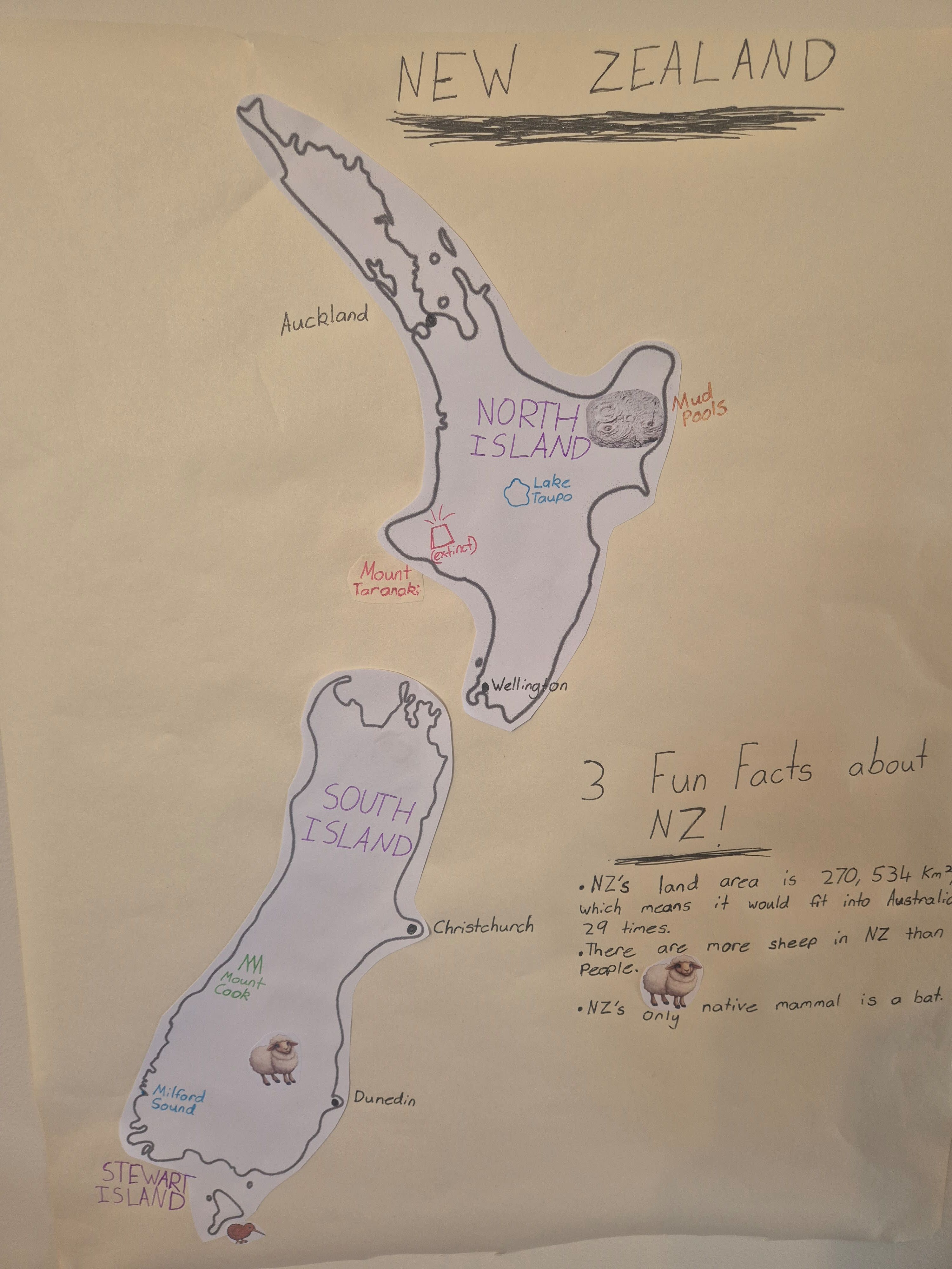
- Audrey represented New Zealand and Fiji with copied maps, building familiarity with each country's shape and location.
- On the New Zealand map, Audrey labeled the North Island and South Island and added city names including Auckland, Wellington, Christchurch, and Dunedin.
- Audrey located physical features and landmarks on the map, including Lake Taupō, Mount Taranaki, Mount Cook, Milford Sound, and mud pools.
- Adding capital cities, other large cities, and landmarks helped Audrey connect place names with their positions on a map.
Language Arts
- Audrey practiced writing place names and geographic vocabulary as labels on the maps.
- Writing three fun facts for each country gave Audrey practice selecting information and expressing it in concise sentences.
- Organizing the facts by country supported clear nonfiction communication and helped readers see which details belong to New Zealand or Fiji.
Visual Arts and Design
- Audrey combined copied map outlines, handwritten labels, and small illustrations to make the information visually engaging.
- Using different colors and symbols helped distinguish features and made the maps easier to scan.
- Arranging the maps and country facts together turned the research into a visual presentation.
Tips
Tips Extend Audrey’s project with a map-and-story mini lesson: use a globe or atlas to locate New Zealand and Fiji, then trace a pretend journey between them and discuss their island settings. Invite Audrey to make a simple legend for the map symbols and use a compass rose to describe where selected cities or landmarks lie. To bring the facts to life, choose one feature from each country for a short research-and-draw page, adding a caption in Audrey’s own words. Finish with a family map quiz in which Audrey gives clues about a city, island, or landmark and everyone finds it.
Book Recommendations
- National Geographic Kids Beginner's World Atlas by National Geographic Kids: An accessible illustrated atlas that can help Audrey explore maps, countries, and geographic features beyond the two countries in the project.
- Maps by Aleksandra Mizielinska and Daniel Mizielinski: A richly illustrated, large-format book that invites readers to explore places around the world through maps and visual details.
- A Child's Introduction to the World: Geography, Cultures, and People by Heather Alexander: A child-friendly introduction to world geography and cultures that connects naturally with Audrey’s country maps and fun facts.
Try This Next
- Map-labeling worksheet: add a compass rose and label selected cities, islands, and landmarks.
- Country-facts quiz: write three clues for each country and have a family member guess the answer.
- Draw a map legend using symbols for cities, mountains, lakes, rivers, and other landmarks.
- Write a short travel journal entry describing a pretend visit to one labeled place in New Zealand or Fiji.